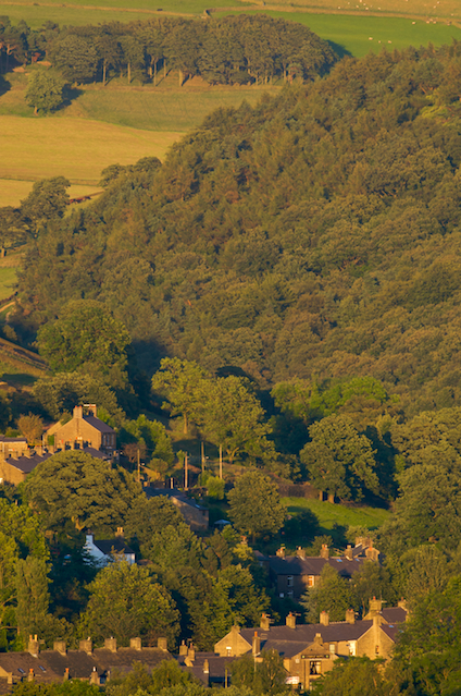
• Home
  • Photography
    • Galleries
      • Mammals
      • Birds
      • Insects
      • Dragonflies and damselflies
      • Wild flowers
      • Galapagos
      • Hayfield landscapes
    • Ramsley Reservoir in August
    • Some lead rake wildlife
    • Video
      • Longhorn moths dancing
  • Locations
    • Hayfield
      • Hayfield parish 1898 maps
      • Hayfield events
      • Platt's Wood
    • Costa Rica
      • Cloud forest at Savegre
      • Premontane wet forest at Las Cruces
      • Tropical wet forest at Esquinas Rainforest Lodge
      • Osa Peninsula
      • Carara National Park
      • Cabo Blanco Absolute Natural Reserve
    • New Mills
      • April wildlife in New Mills
    • Pacific Islands
    • Peak District
      • Moorland in the Peak District
  • About the shack
    • Wildlife identification resources
      • Plant field guides
      • Field equipment
      • Identifying bog moss (Sphagna)
      • Microscopes for naturalists
  • New Mills Natural History Society
    • Field meetings
      • Field meeting reports
        • Old Dale field meeting
        • Lichens near Disley
        • Longstone Edge
        • A limestone dale
    • Indoor meetings
Naturalist's shack

Hayfield

  • Hayfield parish 1898 maps
  • Hayfield events
  • Platt's Wood

Location menu

  • Hayfield
    • Hayfield parish 1898 maps
    • Hayfield events
    • Platt's Wood
  • Costa Rica
  • New Mills
  • Pacific Islands
  • Peak District
  1. You are here:  
  2. Home
  3. Locations
  4. Hayfield

Hayfield

Hayfield parish

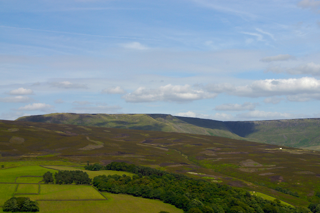
Hayfield is a village nestling on the western edge of the Peak District National Park, with much of the parish lying within the Park. Hayfield parish thus includes some habitats consid ered internationally important, primarily the blanket bog on Kinder plateau. There are a number of Hamlets in the parish, Little Hayfield and Rowarth falling within the National Park, whilst Birch Vale and Hayfield Village itself fall outwith the park boundary.

Read more: Hayfield parish

V16 map

This map shows most of Hayfield village.

Clicking on the small picture of the map will show a larger version. If you want a high resolution version to download, there is a download icon. It is a moderately large download (1.22MB), and is in the PNG format, with full transparency.

View across Middlemoor to Kinder plateau

View across Middlemoor to Kinder plateau

View across Hayfield village towards Elle Bank woods

 View across Hayfield village towards Elle Bank woods

Platt's Wood

Platt's Wood is a community woodland project in Hayfield It is a mixture of wet woodland and grassland on a moderately sloping hillside, previously managed for grazing and now being planted up as a community woodland. You can view the project's Facebook page here.

Read more: Platt's Wood

Subcategories

Hayfield parish 1898 maps

Maps from second edition ordnance survey, 1898

I scanned these maps a few years ago, not long after I first moved to Hayfield.

The maps were from a local library, and I only had an A4 scanner, so I had to scan the whole map in tiles. The tiles overlap quite a lot (at least 50%), because I intended stitching them together when I scanned them.

Anyway, these are the highest resolution available, at 300dpi, and so fairly large files, which is why I haven't yet made them downloadable.

You can also view or download a stitched scan of the V16 1898 map, which covers most of Hayfield village centre.

Meadow Pipit
  • Copyright